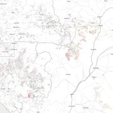
La carte montre les routes forestières légales et illégales dans les six pays du Bassin du Congo.
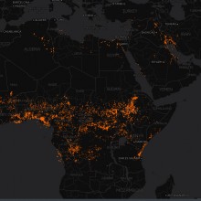
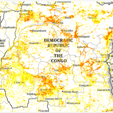
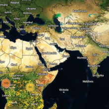
Near real time updates of fire hotspots capture by NASA satellites, covering Central and North Africa
Mise à jour presque en temps réel des points de feu capturés par les satellites de la NASA couvrant l'Afrique Centrale et du Nord.
Les permis d'exploitation, les titres et les concessions des six pays du Bassin du Congo selon les données rassemblées par le World Resources Institute.
Logging permits, titles and concessions in six countries of the Congo Basin according to the data reunited by the World Resources Institute
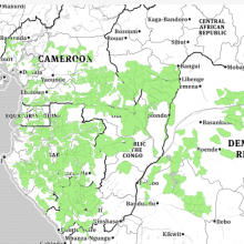
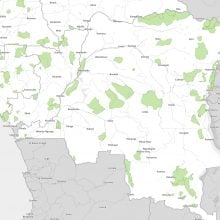
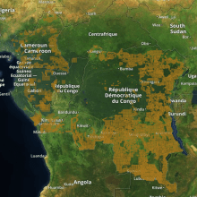
The map shows in green colors the boundaries of protected areas in 6 countries of the Congo Basin
The map shows in green colors the boundaries of protected areas in 6 countries of the Congo Basin
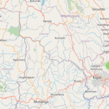
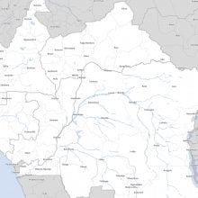
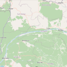
This maps shows great bodies of water - rivers and lakes - of the six countries of the Congo Basin
This maps shows great bodies of water - rivers and lakes - of the six countries of the Congo Basin
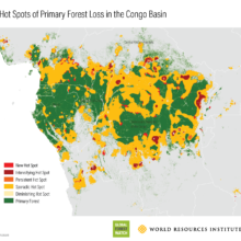
This map features the latest data processed by the University of Maryland for its Global Forest Change. For additional information about these results, please see the associated journal article (Hansen et al., Science 2013)....
Forest height 2011 Remote sensing data showing forest height. Brighter greens correspond to higher vegetation cover. Fish bone patterns indicate roads and human activity. 0mHeight73m Source:NASA Deforestation 1976 – 1991 The hatched yellow areas...
Oil and mining concession according to the status of use (active, in process, in revision) in the six countries of the Congo Basin
Oil and mining concession according to the status of use (active, in process, in revision) in the six countries of the Congo Basin